Introducing FotoLedger: Photo Reports and Site Documentation on the Plan
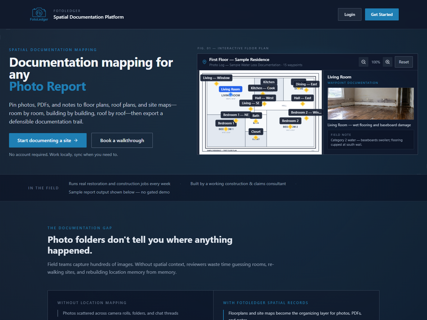
FotoLedger is BetterHolmes Co.'s flagship tool for field photo reports and spatial site documentation. Instead of dumping a camera roll into a PDF, you pin photos, PDFs, and notes to a floor plan, roof plan, or site map — then export a client-ready report that shows where everything happened.
What is FotoLedger?
FotoLedger is a photo report app built for restoration, insurance claims, and construction. Drop waypoints on the plan, attach evidence at each location, and hand off documentation that holds up — for clients, adjusters, and PMs.
Key Features
- Waypoints on plans — Floor plans, roof plans, and site maps as the spatial backbone
- Field photos and notes — Attach images, PDFs, and captions at each location
- Client-ready PDF photo reports — Export a defensible trail, not a folder dump
- Local or cloud — Work without an account, or sign in for sync across devices
- Free while we grow — Start documenting without a sales call
Who Can Benefit?
FotoLedger is built for:
- Restoration and mitigation project managers
- Insurance claims consultants and adjusters who need locatable field photos
- Construction supers tracking progress and punch by room
- Anyone tired of rebuilding reports from unlabeled camera rolls
Getting Started
Try FotoLedger free at fotoledger.com, or contact us if you want help fitting it into your documentation workflow.